How Do FEMA Flood Map Changes Affect Homeowners Insurance on Hilton Head Island?
Quick Answer: FEMA flood map changes can affect a Hilton Head Island property’s flood-zone designation, whether a mortgage lender requires flood insurance, and how the property is evaluated for flood coverage; if a home is placed inside a Special Flood Hazard Area, a lender may require flood insurance even if it was not previously mandatory, and standard homeowners insurance generally does not cover rising water, storm surge, tidal overflow, or other external flooding.
What FEMA Flood Map Changes Actually Mean
A FEMA flood map change does not mean your house physically changed overnight. It means the way the property’s flood risk is classified may have been updated based on newer data like elevation, drainage, and coastal modeling. Many homeowners assume a map change means their home is suddenly at immediate risk of flooding, but that is not necessarily the case, because flood maps are updated over time as FEMA refines how it evaluates flood exposure.
For some properties, the change may be minor, while for others the home may be placed into a Special Flood Hazard Area (SFHA), which can trigger lender requirements for flood insurance. This is where confusion often begins, since a home that never required flood insurance before may now fall into an AE or VE zone even though nothing about the property itself appears different.
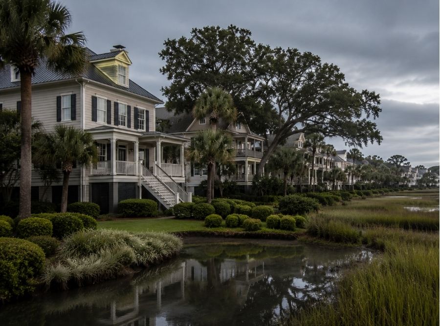
On Hilton Head Island, this can be especially surprising because flood exposure is not always obvious. Areas near marshes, lagoons, or low-lying terrain can be affected even if they are not directly on the ocean, and flood maps are not just measuring distance from the water but instead reflect broader flood behavior across the coastal environment.
How Flood Map Changes Affect Insurance and Mortgage Requirements
One of the biggest misconceptions homeowners have is believing FEMA flood maps only matter if someone actually files a flood claim. In reality, these maps often influence mortgage requirements long before any flooding occurs.
If a lender determines a property now falls inside a FEMA-designated Special Flood Hazard Area, flood insurance may become mandatory—even if the homeowner previously carried none. This can come into play during purchases, refinancing, renewals, or lender compliance reviews. Lenders rely on current flood determinations, not past assumptions or what a previous owner experienced, which is why buyers are sometimes surprised late in the closing process when updated flood-zone information triggers a new requirement.
Another common misunderstanding involves homeowners insurance itself. Many homeowners assume their standard policy includes flood protection because it covers certain storm-related damage. It generally does not. Wind damage and flood damage are handled separately—homeowners insurance may cover wind-driven roof damage or rain entering through a storm-created opening, while rising water, storm surge, tidal overflow, and external flooding typically require a separate flood policy.
This distinction is especially important on Hilton Head Island, where hurricanes and tropical systems often involve both wind and flood-related losses at the same time.
What Do AE, VE, and X Flood Zones Mean?
Flood-zone terminology creates a tremendous amount of confusion because the labels themselves often sound more technical than homeowners expect. An AE zone generally indicates a higher-risk flood area where FEMA has established a Base Flood Elevation, while VE zones usually involve coastal areas with additional wave-action exposure tied to storm surge and beachfront flooding. Shaded X zones may indicate moderate-risk areas, and unshaded X zones are often viewed as lower-risk flood areas.
One of the most important things homeowners need to understand is that a lower-risk flood zone does not mean no flood risk, and a higher-risk flood zone does not automatically mean the house will flood every storm season. Flood maps are risk-management tools, not guarantees.
We regularly speak with homeowners who assume a Zone X designation means flood insurance is unnecessary because the lender no longer requires it, only to encounter unexpected water intrusion from major rainfall events, drainage issues, tidal flooding, or tropical systems. Conversely, some homeowners panic after seeing an AE designation without understanding how elevation certificates, home elevation, construction details, or mitigation factors may still influence actual flood-insurance costs.
This is where elevation documentation becomes extremely important. Many older Hilton Head homes were built decades ago, and elevation certificates may be outdated, incomplete, or missing entirely. In some cases, updated elevation documentation can materially affect how the property is reviewed for flood insurance, as elevated homes—particularly newer construction or rebuilt coastal properties—may be evaluated differently from older slab-on-grade homes sitting at lower elevations. That distinction becomes increasingly relevant as flood information, underwriting standards, and FEMA evaluations continue evolving.
Why Flood Insurance Reviews Matter More on Hilton Head Than Many Owners Realize
Flood exposure on Hilton Head Island is not limited to direct oceanfront property. Some of the most complicated flood situations involve homes affected by marsh proximity, tidal influence, lagoon systems, heavy rainfall accumulation, drainage limitations, groundwater behavior, and stormwater backup during major weather events. This is one reason many homeowners are surprised when flood-zone determinations affect properties that are not sitting directly beside the beach.
Throughout communities like Sea Pines, Forest Beach, Palmetto Dunes, Port Royal Plantation, and parts of Hilton Head Plantation, elevation differences can change significantly within relatively short distances. One property may fall inside a lender-required flood zone while another nearby home does not, which often creates confusion between neighbors comparing premiums or requirements without realizing their elevation details, structure characteristics, or flood-zone determinations may differ substantially.
Second homes and vacation properties add another layer of complexity. Out-of-state owners may overlook important flood notices due to mail handling issues, seasonal occupancy, or delays in property-management communication. In some cases, homeowners only realize flood insurance became mandatory after the lender begins force-placing coverage onto the mortgage, which can be more expensive than reviewing options early.
Condo Owners Should Review the Association’s Flood Policy
Condo owners may assume the HOA flood policy automatically protects everything connected to their unit, but association coverage and individual unit-owner exposure can work very differently. The association’s policy often focuses on the building and common property, while personal belongings, interior upgrades, temporary housing costs, and other owner-specific exposures may require separate review.
The exact responsibilities depend on the association documents and master policy, so condo owners should review the association’s flood coverage, limits, deductible, and division of responsibility before assuming they do not need additional protection.
Why Current Flood-Zone Information Matters
Coastal flood exposure continues evolving across parts of the Lowcountry, influenced by storm-surge modeling, repetitive heavy-rain events, tidal flooding behavior, drainage-system stress, groundwater saturation, and coastal development patterns. Even outside major hurricanes, Hilton Head homeowners may encounter standing water, overwhelmed drainage areas, lagoon overflow, roadway flooding, or heavy rainfall events that behave differently than they did years ago.
This does not mean every property suddenly faces catastrophic flood risk, but relying on outdated assumptions can create serious insurance blind spots. Many homeowners still base decisions on what a previous owner said, whether a lender once required flood insurance, or whether the property has flooded before, even though those factors may not reflect current evaluations.
A more reliable approach is reviewing the property proactively before hurricane season, before a renewal issue develops, and before a closing deadline creates unnecessary pressure.
Review the Map Before a Lender or Storm Tests It
FEMA flood maps and property-specific flood determinations can affect whether a Hilton Head Island homeowner is required to carry flood insurance, how a lender reviews the property, and what documentation may be needed. For some homeowners, a flood-zone change may have little impact, while for others it may create a new insurance requirement or make an updated elevation certificate and coverage review more important.
Many homeowners do not realize how exposed they are until a lender notice, flood-zone reclassification, closing issue, or major storm forces the conversation. At Coastal Haven Insurance, we help homeowners throughout Hilton Head Island, Bluffton, Okatie, Beaufort, and the surrounding Lowcountry review flood-zone determinations, compare NFIP and private flood-insurance options, evaluate elevation-related factors, and understand how FEMA flood maps may affect both the property and its insurance needs.
On Hilton Head Island, flood risk is not just about whether water reaches the property, but whether the homeowner understands the exposure before the next storm arrives. Flood-zone designations, lender requirements, insurance options, and underwriting rules can change, so homeowners should confirm current information with their lender, insurer, FEMA resources, and qualified local professionals before making insurance or real-estate decisions.