How Does an Elevation Certificate Lower My Flood Insurance Costs in Hilton Head, SC?
Quick Answer:
An elevation certificate can lower flood insurance costs in Hilton Head by giving insurers accurate documentation of how high your home sits compared to the area’s Base Flood Elevation. If the certificate shows the lowest floor, utilities, and foundation are elevated favorably, the property may qualify for better flood insurance rating. It does not guarantee a lower premium, but it can prevent your flood policy from being priced with incomplete or overly conservative elevation assumptions.
Flood insurance can feel frustratingly unclear for Hilton Head homeowners because two homes on the same street can receive very different premiums.
One owner may be paying thousands more than a neighbor and have no idea why. Another may own a raised coastal home and assume the elevation should already be reflected in the price, only to discover the insurance company never had the documentation needed to rate it accurately. In many cases, the missing piece is not the home itself. It is the paperwork proving how the home is actually elevated.
That is where an elevation certificate becomes important.
For homeowners in Hilton Head Island, Sea Pines, Palmetto Dunes, Forest Beach, Hilton Head Plantation, Wexford, Shipyard, Shelter Cove, and other coastal Lowcountry communities, an elevation certificate can be one of the most useful documents in a flood insurance review. It helps show how the structure compares to FEMA flood elevations, how the foundation is built, where the lowest floor sits, and whether certain building features may reduce or increase flood risk.
The certificate does not magically remove flood exposure, and it does not automatically eliminate the need for flood insurance. But when the home is elevated well, properly documented, and accurately rated, it may help correct inflated pricing and give insurers a clearer picture of the property’s actual risk.
What an Elevation Certificate Actually Shows
An elevation certificate is a FEMA-related document that records key elevation details about a building, including the lowest floor elevation, foundation type, flood zone, and how the structure compares to the Base Flood Elevation.
FEMA describes the Elevation Certificate as a tool used to provide elevation information for floodplain management compliance and flood insurance purposes. It can also support certain map-change requests, such as a Letter of Map Amendment, when appropriate.
For homeowners, the most important point is that an elevation certificate gives the insurance company something more precise than a general flood-zone label. Flood zone matters, but it is not the whole story. The actual elevation of the building, the lowest finished floor, the foundation design, flood openings, attached enclosures, and utility placement can all influence how flood risk is evaluated.
This distinction matters in Hilton Head because many homes are built in areas where elevation changes subtly from lot to lot. A home near a lagoon in Sea Pines, a marsh-adjacent property in Hilton Head Plantation, or a raised home near Forest Beach may not rate the same way as another property just a short distance away. The flood map may identify the broader risk area, but the elevation certificate helps document how the specific structure sits within that risk environment.
Many homeowners assume the insurance company already knows this information. Sometimes it does. Often, it does not. Older homes may have missing documentation, outdated certificates, or surveys from prior ownership that do not fully reflect current underwriting needs. Renovations, enclosed lower areas, relocated utilities, and changes to the property can also make old documentation less useful.
That is why an elevation certificate can become so important during a flood insurance review. It replaces assumptions with property-specific information.
How Elevation Can Affect Flood Insurance Pricing
Flood insurance pricing is influenced by many property-specific factors, and elevation is one of the most important because it helps show how vulnerable the home may be to floodwater.
FEMA’s National Flood Insurance Program notes that flood risk can be evaluated using factors such as proximity to a flood source, occupancy type, construction type, number of floors, foundation type, rebuild cost, and claim history. FEMA also explains that elevation certificates can help evaluate first-floor height and may help lower the cost of flood insurance coverage.
For a Hilton Head homeowner, the practical meaning is simple: if the home is being rated without accurate elevation information, the premium may not reflect the true position of the structure. If the certificate shows that the lowest floor is properly elevated above the Base Flood Elevation, the insurer may be able to rate the policy more favorably. If the certificate shows that critical systems like HVAC equipment or utilities are elevated as well, that may also support a more accurate review.
The opposite can also happen. If the certificate shows a low slab foundation, non-compliant enclosure, missing flood vents, or utilities positioned below expected elevation, it may confirm why the premium is high. That can still be valuable because it helps the homeowner understand what is driving the cost instead of assuming the rate is random.
This is one of the biggest misunderstandings about flood insurance. Many homeowners think the flood zone alone determines the premium. In reality, the zone is only part of the picture. A raised home in a higher-risk zone may sometimes rate better than expected when the elevation documentation is strong, while a lower home in a similar area may face more pricing pressure because the structure is more exposed.
That is why comparing premiums with a neighbor can be misleading. Two homes may look similar from the street but have very different lowest-floor elevations, foundation types, flood openings, enclosure details, utility placement, or prior flood documentation.
Why Hilton Head Homes Often Need a Closer Elevation Review
Hilton Head’s coastal geography makes elevation especially important because flood exposure does not always look obvious.
A property does not have to sit directly on the ocean to have meaningful flood risk. Homes near marshes, lagoons, tidal creeks, low-lying roads, drainage corridors, and high-groundwater areas may still face flood exposure during heavy rainfall, storm surge, tidal flooding, or tropical systems. In some neighborhoods, small elevation differences between lots can materially affect both risk and insurance pricing.
This is common in older island communities where homes were built across different construction eras. Sea Pines, Shipyard, Forest Beach, Port Royal Plantation, and parts of Hilton Head Plantation include many homes built before newer floodplain and coastal construction expectations became common. Some have been elevated or renovated over time, while others may still have lower foundations, older utility placement, or enclosed areas beneath raised living spaces.
Those lower enclosures are often a hidden issue.
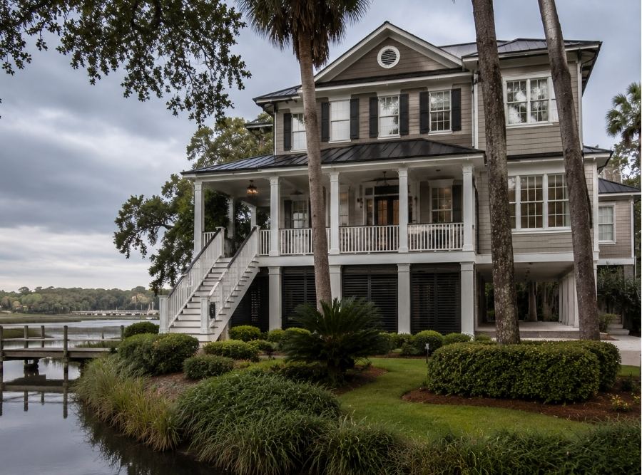
A homeowner may think the home is “raised” and therefore should automatically qualify for better flood pricing. But if the area below the elevated floor is enclosed improperly, lacks appropriate flood openings, contains finished living space, or houses mechanical equipment below flood elevation, the insurance rating may be affected. The home may be elevated in one sense, but still carry flood-related features that underwriters need to evaluate carefully.
Vacation homes and second homes create another complication. Owners may not know whether an elevation certificate exists because the document was never transferred clearly during purchase. Sometimes the certificate is buried in old closing paperwork, stored with a prior survey, held by a previous owner, or never completed at all. When renewal pricing increases or a lender asks for documentation, the owner suddenly has to track down records under time pressure.
A proactive review is much easier than a rushed one during closing week or hurricane season.
What an Elevation Certificate Can and Cannot Do
An elevation certificate can help lower flood insurance costs when it gives the insurer better information that supports a more favorable rating. It can also help identify whether the current rating appears reasonable, whether the home’s elevation is being interpreted correctly, and whether missing information may be causing unnecessary pricing pressure.
But it is not a magic exemption from flood insurance.
An elevation certificate does not automatically remove a home from a flood zone, cancel a lender requirement, or guarantee a lower flood insurance premium.
That misconception causes a lot of frustration. Some homeowners order a certificate expecting it to make flood insurance disappear. In reality, the certificate documents elevation. It may support better rating, and in some cases it may support a FEMA map-change request such as a Letter of Map Amendment, but that is a separate process with its own requirements. FEMA’s certificate instructions state that elevation information can be used to inform the proper insurance premium and support certain map amendment or revision requests.
The certificate also does not override every lender decision. If the lender determines flood insurance is required based on the current flood determination, the homeowner may still need a flood policy even if the home is elevated. The value of the certificate is that it may help the policy get rated more accurately and may help clarify whether additional options should be reviewed.
It is also important to understand that not every certificate produces savings. Sometimes the documentation confirms that the current premium is appropriate. Sometimes it shows that a home is more exposed than the owner realized. Even then, the information is still useful because it gives the homeowner a clearer basis for decision-making.
In flood insurance, guessing is expensive. Documentation gives everyone a better starting point.
Why Utilities, Enclosures, and Crawlspaces Matter More Than People Expect
Many homeowners think elevation only means the height of the main living floor. That is part of the picture, but it is not the only part.
Insurers and underwriters may also care about what sits below that floor. HVAC systems, electrical equipment, water heaters, enclosed storage areas, crawlspaces, flood vents, and lower-level improvements can all influence how flood exposure is understood. A beautifully elevated home can still create rating concerns if expensive mechanical systems sit below the expected elevation or if the lower enclosure is not built to floodplain standards.
This matters throughout Hilton Head because elevated coastal construction is common, especially in areas near marshes, lagoons, and beach-access neighborhoods. Some homes have open foundations designed to allow water movement. Others have enclosed ground-level storage areas that may have been modified over time. In vacation-heavy communities, those lower areas are sometimes used more casually than the owner realizes, which can create insurance and compliance concerns.
The elevation certificate helps document these details in a formal way.
That can be especially helpful when an insurer questions why the premium should be lower or why a home should be rated differently from another property nearby. Instead of relying on photos, estimates, or verbal explanations, the certificate provides standardized elevation measurements completed by a qualified professional.
For homeowners trying to reduce flood insurance costs, this is where the conversation often becomes more practical. If the certificate shows that utilities are too low, flood vents are missing, or an enclosure is creating rating pressure, the next step may not be simply shopping for a different policy. It may involve understanding whether physical improvements, documentation updates, or mitigation changes could help reduce future exposure.
When Hilton Head Homeowners Should Consider Getting One
A Hilton Head homeowner should consider reviewing or obtaining an elevation certificate when flood insurance feels unusually high, when a lender requests flood documentation, when buying or selling a coastal property, when the home is elevated but not receiving favorable pricing, or when older paperwork cannot be found.
This is especially important for homes in AE or VE flood zones, properties near marshes or lagoons, waterfront homes, elevated homes with lower enclosures, older homes without clear documentation, and properties being used as second homes or vacation rentals. It can also be useful after renovations if the work changed the lower level, foundation, utilities, or enclosed areas in ways that may affect flood underwriting.
A common mistake is waiting until the last minute.
During a real estate transaction, missing elevation documentation can slow down flood quotes, create lender concerns, and introduce uncertainty for buyers. During renewal season, it can leave the homeowner accepting a high premium without knowing whether better documentation might have helped. During hurricane season, it may be too late to solve the issue cleanly before storms create urgency across the market.
The better approach is to review the flood policy, flood zone, certificate status, and property details before the need becomes immediate.
For many homeowners, the first step is simply finding out whether an existing certificate already exists. It may be in prior closing documents, permit records, survey files, or local floodplain documentation. If no usable certificate exists, then ordering a new one from a qualified professional may be worth considering as part of a broader flood insurance review.
Better Documentation Can Mean Better Decisions
An elevation certificate can help lower flood insurance costs in Hilton Head when it proves the home sits higher, is built more favorably, or has property-specific features that support better flood rating. It can also help identify why a premium is high, whether the current rating is based on incomplete information, and whether NFIP or private flood insurance options should be reviewed more carefully.
The larger point is that flood insurance should not be treated as a mystery bill.
On Hilton Head Island, where marshes, lagoons, storm surge, heavy rainfall, and changing flood maps all shape coastal risk, accurate elevation documentation can make a meaningful difference in how a property is understood. It gives homeowners, lenders, insurance carriers, and agents a clearer view of the home’s true flood exposure instead of relying on assumptions.
At Coastal Haven Insurance, we help homeowners throughout Hilton Head Island, Bluffton, Okatie, Beaufort, and the surrounding Lowcountry review flood insurance, elevation documentation, FEMA flood zones, and private flood options with the care coastal properties deserve. The goal is not just to find a lower premium. The goal is to understand why the policy costs what it does and whether the home is being rated as accurately as possible.
Because in coastal South Carolina, the right documentation can be the difference between guessing at flood risk and actually understanding it.
Coastal Haven Insurance Partners is an independent, locally owned insurance agency located in Bluffton, SC (40 Pennington Dr Suite E). Led by partners Coley Davis, Travers Davis, and William Voelkel, the firm brings over 30 years of combined insurance and leadership experience to the South Carolina Lowcountry. The team specializes in tailored homeowners, flood, windstorm, auto, and commercial insurance. They share straightforward guidance to help coastal residents and business owners protect their assets with confidence.